Plan Framework
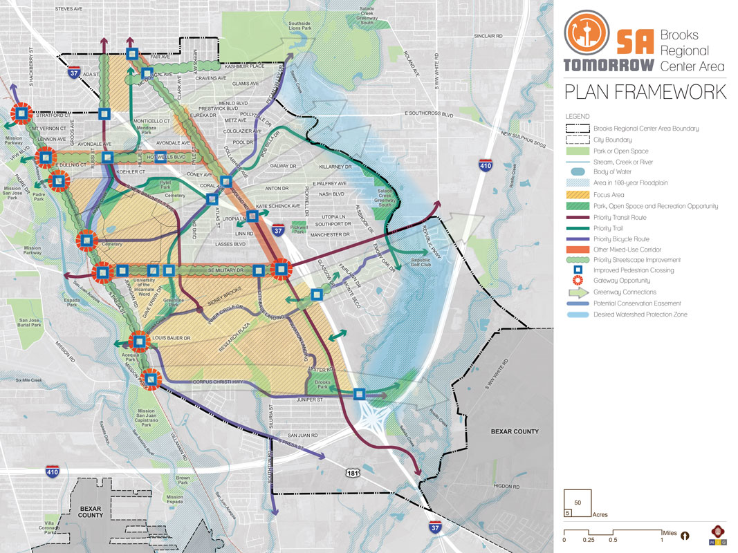
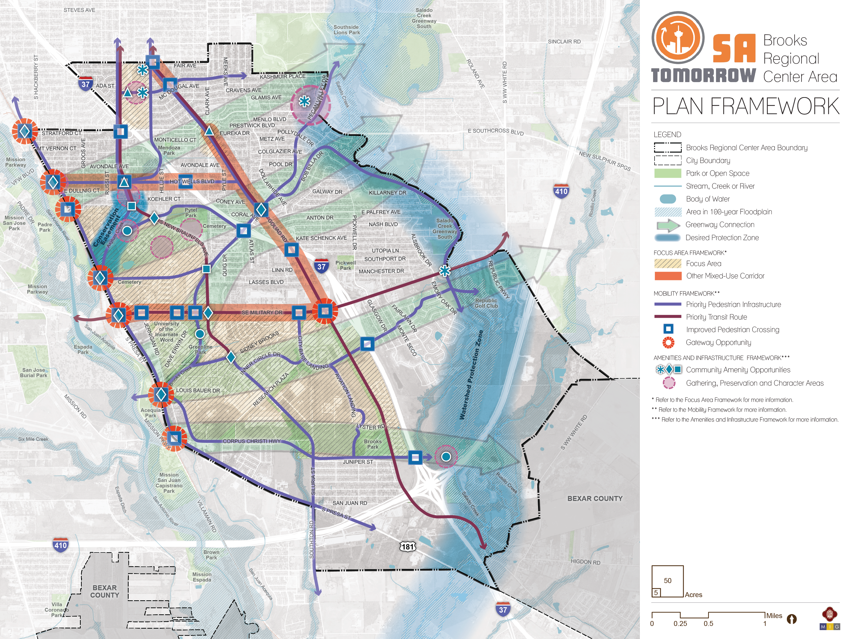
The Plan Framework map identifies and shows the interrelatedness of key physical concepts and strategies in the plan. These include priority focus areas for (re)development; recommended pedestrian, bicycle, and street improvements; parks and open space recommendations; and priority areas to encourage mixed-use corridors. These recommended physical improvements and investments are complemented by other supportive plan strategies related to housing; economic development; infrastructure; and neighborhood priorities.
The Brooks Area Regional Center focuses growth and new development in appropriate areas, while ensuring protection of established single-family neighborhoods, sensitive lands, and natural features. Gateway treatments along South Presa Street and at the intersection of Goliad Road and Southeast Military Drive will announce and celebrate the entry to the creeks, greenways, and mixed-use centers throughout the area. The largely rural character of the southernmost parts of the plan area will be preserved.
Mobility improvements focus on enhancing east-west connectivity, including improved access to the San Antonio River and Salado Creek. Improved pedestrian and bicycle infrastructure are key priorities for existing and new neighborhoods, especially around community destinations such as schools, parks, libraries, and community and senior centers. Key corridors will be improved to create pedestrian-friendly environments for residents and businesses as well as increase safety and comfort for all. Greenways that follow and extend from existing creeks will connect open spaces, parks, and community destinations and create opportunities for environmental protection and environmentally-sensitive development.